How to Geotag Photos for Google Business Profile

To geotag photos for Google Business Profile, you write GPS coordinates into the image file itself, before you upload it. Google's photo uploader has no location box: there is nowhere on that screen to type an address, so the only place a location can travel is inside the file. Doing it takes about a minute per photo. Whether it lifts your ranking is a separate question, and the published tests say it does not.
This guide covers both: the steps, and the evidence. If you only want the honest summary, skip to the ranking section.
What Google does with a photo you upload
Google publishes what it will accept, and it is worth reading before you spend an afternoon on this. Photos must be JPG or PNG, between 10 KB and 5 MB, at least 250 pixels tall and wide, with 720 by 720 recommended. Google also asks that a photo "should be in focus and well lit, and have no significant alterations or excessive use of filters", on its Business Profile photo help page.
Read that page and notice what is absent. It does not mention location data, GPS, EXIF or geotagging anywhere. Google specifies the file type, the file size and the sharpness, and says nothing at all about what the file remembers about where it was taken.
Before you change anything, find out what your photos already hold. A photo taken on a phone with location services switched on usually carries coordinates already; a photo that has been through a messaging app usually does not. You can see what location your photos already carry before deciding whether any of this applies to you.
How to geotag photos for Google Business Profile
- Check whether the photo already carries a location, since many phone photos do.
- Get the coordinates of the exact spot you want the photo to record.
- Write those coordinates into the file, before it goes near your profile.
- Check the hemisphere letters; a wrong one moves the photo across the world.
- Upload through your profile, inside the file-size limits above.
Step 2 in practice. A mapping app hands you a decimal pair, but the file does not store it that way: it stores degrees, then minutes, then seconds. Take the Royal Observatory in Greenwich, published as 51.477 N, 0.0147 W.
The whole degrees stay as they are: 51. Multiply the remaining 0.477 by 60 and you get 28.62, so 28 minutes; multiply that remaining 0.62 by 60 and you get roughly 37 seconds. The file holds 51 degrees, 28 minutes, 37 seconds. That is exactly the form Wikipedia publishes for the same point, so you can check your arithmetic against it.
The longitude is the one that catches people. Multiply 0.0147 by 60 and you get 0.88, so zero minutes; multiply 0.88 by 60 and you get about 53 seconds, giving 0 degrees, 0 minutes, 53 seconds.
The minus sign has vanished. It has not been lost. It has been replaced by a separate letter, W, stored beside the number. That is why a geotag sometimes lands on the wrong continent: the number survived and the letter did not.
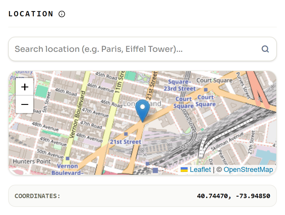
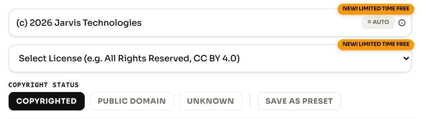
Step 3 in practice. Once you have the coordinates, they have to go into the file. Open the photo, pick the point on the map, and write the coordinates into the file. The same screen carries the description, creator, credit and copyright fields, which matter for a reason covered further down.
The location fields inside your photo, in plain English
A geotag is not one value. It is a small group of fields, and knowing what each does is what stops you making the mistake above. These are the names you will see in any tool that reads a photo, including ours.
| What you set | The field it writes | Why it matters to you |
|---|---|---|
| The pin on the map | GPSLatitude, GPSLongitude |
The position itself, kept as degrees, minutes and seconds rather than the decimal pair you copied out of a map. |
| Which side of the equator and the meridian | GPSLatitudeRef, GPSLongitudeRef |
One letter each: N, S, E or W. Your longitude is stored with no minus sign, so this single letter is the only thing keeping a London shop out of Kazakhstan. |
| Height above sea level | GPSAltitude, GPSAltitudeRef |
The height is stored as a plain positive number, so the separate above-or-below flag is the only thing that tells a rooftop terrace from a basement bar. |
| Which way the camera faced | GPSImgDirection |
Where the lens was pointing, not where you were standing: the difference between a photo of your shopfront and a photo taken from inside it. |
| When the position was taken | GPSDateStamp, GPSTimeStamp |
The date and time the reading was recorded. This is what turns a photo into a dated record of having been somewhere, which is the part that is genuinely useful. |
Those names come from the ExifTool GPS field reference, which is where to look for the complete list rather than the five that matter.
Will this move you up in the map results?
No. Three people have published tests, and the honest summary has some nuance in it, which is why most pages on this subject either overclaim or skip it entirely.
Two of the three found nothing. A local search agency tested five profiles in January 2024 and reported no measurable impact on rankings in the local pack. A consultant ran eighteen geotagged posts on a profile the following month and concluded that the tactic has no effect on local rankings.
The third test was much larger. An agency took 27 of its lawn care clients and paused all other search work for ten weeks. For five weeks it posted two photos a week with the location stripped out, establishing a clean baseline; for the next five it posted the same way, with coordinates pointing at two nearby towns.
It measured seven things. One improved: "near me" searches inside the exact towns that had been tagged. Four of the other six got worse, including searches that name the town, which is what a customer types when they already know where they want to go. The published write-up ends with the agency deciding to stop geotagging client images.
So the fair reading is not that geotagging does nothing. It is that the single narrow gain came with larger losses attached, and that no one has reproduced the gain. Google's John Mueller had answered the question on Reddit in five words: "No need to geotag images for SEO." A longer look at the evidence is in what the evidence says about photo rankings.
The half of the metadata Google says it does read
This is the useful part, and it comes from Google rather than from anyone's test. Asked directly how important EXIF data is, Gary Illyes of Google Search answered in a published Search Office Hours session: "Google doesn't use EXIF data for anything at the moment. The only image data, or metadata, that we currently use is IPTC."
Two things follow from that sentence. GPS coordinates live in the EXIF half of the file, the half Google says it does not use. The caption, creator, credit and copyright details live in the IPTC half: the half Google says it does.
If you are going to spend time filling in fields on your photos, fill in those. Not because it will rank you, but because it is the only image metadata Google has publicly said it reads, and because it records who made the picture.
On the related claim that Google reads your coordinates and then deletes them: Google has never documented either half of it. What practitioners report is the deletion: download a photo back from a profile and the location is gone. The "reads it first" half is described as speculation by the very study that reports it.
What the location is genuinely good for
A geotag is a record, not a lever. It answers "where was this taken, and when" in a way a filename and a folder never can, and it answers it years later when nobody remembers.
That record earns its keep in ordinary business situations. A contractor photographing a finished job has proof the work happened at that address on that date. An inspector filing a report has the same.
An estate agent with four hundred listing photos can tell which property each one belongs to without opening them. A business with three sites can tell which kitchen, or which chair, a photo came from.
So tag your photos because you want to know where they were taken. That reason survives every algorithm change, which is more than the other one manages. For how a location is physically held inside an image, we cover how a location is stored inside a photo separately.