What Is Geotagging? The Tags Behind a Located Photo

What is geotagging? It is the process of storing a geographic location inside a file. For a photo, that location is written into the image's own metadata, the EXIF block that already carries the shutter speed, the lens and the timestamp, as a set of GPS tags. The coordinates travel inside the JPEG itself, so a geotagged photo answers the question "where was this taken?" without a caption, a folder name or a database.
What is geotagging writing into a photo, exactly
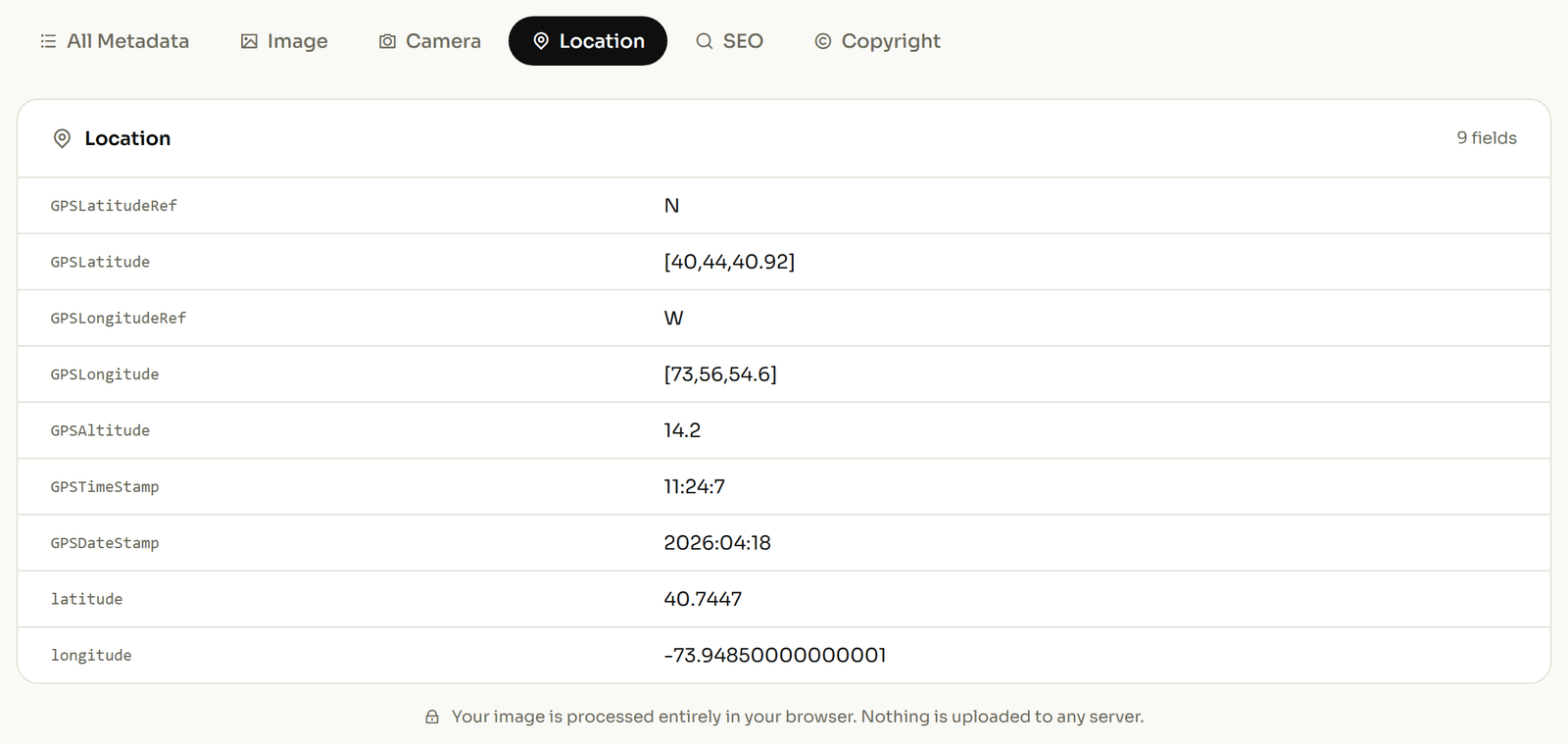
Most explanations stop at "it adds GPS data." The names are worth knowing, because they are what you see listed when you open a photo in any tool that reads metadata. Spotting which one is missing is usually the difference between a location that works and one that does not.
| What it records | Called | Why you would care |
|---|---|---|
| How far north or south | GPSLatitude |
The first half of the pin on the map. |
| Which side of the equator | GPSLatitudeRef |
A single letter, N or S. The number above is always positive, so this letter is the only thing telling London apart from a point the same distance below the equator. |
| How far east or west | GPSLongitude |
The other half of the pin. |
| Which side of Greenwich | GPSLongitudeRef |
E or W. Lose this one letter and your photo relocates to the opposite side of the world. It is the most common way a geotag ends up plainly wrong. |
| Height, and whether it is above or below sea level | GPSAltitude and GPSAltitudeRef |
The height is stored as a plain positive number, so the second flag is all that separates a rooftop from a basement. |
| Which way the camera was facing | GPSImgDirection |
Where the lens was pointing, not where the photographer stood. It is what distinguishes a photo of a shopfront from one taken inside it. |
The pattern worth taking away: the coordinates are always stored as positive numbers, and a separate one-letter tag carries the direction. That split is the source of most broken geotags, and it is the subject of the next section. The full technical list, if you ever need it, is in the ExifTool GPS tag reference.
A real coordinate, written out
Here is where the Ref tags earn their place. Take the prime meridian marker at the Royal Observatory in Greenwich, which sits at roughly 51.477928, -0.001545 in the decimal form every mapping app shows you.
Your photo does not store it that way. It breaks the number into degrees, minutes and seconds, the old navigator's format still used on charts, and it never keeps the minus sign. The latitude converts like this:
- 51.477928° → whole degrees: 51
- 0.477928 × 60 = 28.67568 → whole minutes: 28
- 0.67568 × 60 = 40.54 seconds
So GPSLatitude becomes 51, 28, 40.54 and GPSLatitudeRef becomes N. The longitude is negative in decimal, and that negative sign is the part people lose:
- 0.001545 × 60 = 0.0927 → whole minutes: 0
- 0.0927 × 60 = 5.56 seconds
GPSLongitude becomes 0, 0, 5.56, positive, and the west of Greenwich part is carried entirely by GPSLongitudeRef, which holds the single character W. Strip that one-byte tag and the photo claims a spot in the eastern hemisphere. It is the most common way a geotag ends up pointing at the wrong side of the world.
How a photo gets geotagged
There are only two routes, and which one you need depends entirely on whether the location was recorded at the moment of capture.
At capture. A phone with location services enabled writes the GPS tags as it saves the file. So does a camera with built-in GPS, or one paired with a phone or a separate GPS logger. Nothing else is required, because the coordinates are in the file from the start.
Afterwards. If location was switched off, if the camera has no GPS, or if the tags were stripped somewhere along the way, the coordinates can be written in later. This is the ordinary case for anyone shooting on a DSLR, and for any photo that has already been through a platform that removes metadata. You pick the point on a map and add the coordinates yourself; the tags written are exactly the ones in the table above.
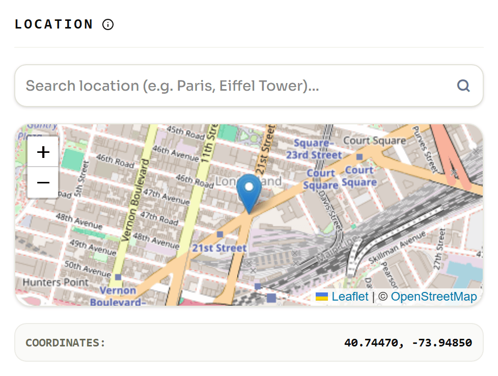
If you want the process rather than the concept, the step-by-step guide to geotagging photos covers it start to finish.
Does geotagging help your Google Business Profile?
It deserves a straight answer rather than the one the SEO industry has repeated since 2022.
The claim is that uploading geotagged photos to a Google Business Profile tells Google where your business operates and lifts your local ranking. It was tested properly in 2025. An agency ran a 10-week controlled study across 27 lawn care businesses: five weeks of normal posting, then five weeks of the same schedule with coordinates added, and published the result in March 2025. Of seven metrics, one improved: "near me" queries in the areas that were tagged. Four of the rest got worse.
So: geotagging is not a ranking lever, and any page still promising that it is has not looked at the evidence. What geotagging genuinely does is quieter and more durable. It keeps a verifiable record of where an image was made. For a contractor documenting a job site, an inspector filing a report, or an estate agent with four hundred listing photos, that record is the point. The location is proof, not a ranking signal.
What survives an upload
A geotag lives in the file, which means it only travels as far as the file does intact. Plenty of platforms strip the location out on upload. The visible picture survives, the GPS block does not.
The usual explanation is wrong, and worth correcting. Stripping is not a side effect of compression: Google Photos and Flickr both re-compress what you upload and keep the metadata intact, while other services discard it from files they barely touch. Whether your location survives is a policy decision made by each platform, not a technical consequence of resizing. Which means you cannot reason it out from how squashed the photo looks. You have to check.
So do not assume a photo still carries its location because it did when it left your phone, and do not assume one you downloaded has been scrubbed. Looking takes about ten seconds.
How to check whether a photo is geotagged
Open the photo in a tool that reads the EXIF block and look for the tags in the table above. If GPSLatitude and GPSLatitudeRef are present, the photo knows where it was taken; if the GPS section is empty, it does not, and no amount of folder naming will change that. You can open the photo in our EXIF viewer to see the full tag list for any image.
Whatever you find, it can be changed. A missing location can be written in; one you would rather not publish, on a photo of your own home say, can be stripped back out. Same tags, opposite directions.