Editable Photo Metadata Tags: What You Can Change and Why
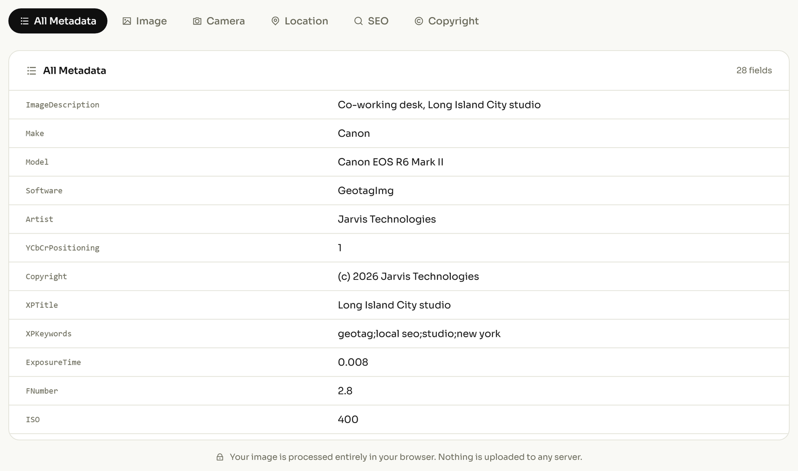
A photo carries three separate blocks of metadata, and the editable photo metadata tags sit almost entirely in two of them. Your camera writes the first block by itself: exposure, lens, timestamp, GPS. People write the other two: caption, creator, copyright, place names, keywords.
ExifTool's documentation catalogues 33,487 tags with 21,437 distinct names, and the great majority are writable. That is far more than anyone needs. What follows is the working subset: the tag, what it holds, why you would touch it, and what reads it back.
EXIF vs IPTC vs XMP: which block holds what
| Block | Who writes it | What it holds |
|---|---|---|
| EXIF | Your camera or phone, automatically | Exposure, lens, timestamp, GPS coordinates |
| IPTC | A person, after the shot | Caption, creator, credit, copyright, place names |
| XMP | Editing software | The same fields again, plus vendor extras |
The awkward part is the third row. XMP duplicates much of what IPTC already holds, so a caption can exist in two places at once with two different values, and which one you see depends on which program opened the file.
The Metadata Working Group exists to settle exactly this: its guidelines reconcile overlapping EXIF, IPTC and XMP tags when reading and synchronise them when writing. Good software follows them, and not all software is good software, which is why a caption set in one app sometimes fails to appear in another.
IPTC is the older of the two, and ExifTool's notes describe it as "slowly being phased out in favor of XMP". It is not gone. Picture desks still read it, but when a field exists in both, XMP is the one with a future. You can read every tag your own photo already carries to see which blocks are filled in.
The location tags you can edit
Location is the most-edited group in the file, and the one people get wrong most often. These are documented in the ExifTool GPS tag reference.
| Tag | What it holds | Why you would touch it | What reads it |
|---|---|---|---|
GPSLatitude, GPSLongitude |
Where the camera stood | To give a location to a photo that never recorded one | Anything that drops a pin on a map |
GPSLatitudeRef, GPSLongitudeRef |
North or south, east or west | The coordinate itself is stored with no minus sign. This pair is the only thing keeping you on the correct side of the planet. Lose it, and a London photo claims to be in the eastern hemisphere | Every map tool, silently |
GPSAltitude, GPSAltitudeRef |
Height, and whether it is above or below sea level | The height is stored as a plain positive number, so this one flag is the only thing separating a rooftop from a basement | Drone and survey software |
GPSImgDirection, GPSImgDirectionRef |
The compass bearing the camera faced, against either true or magnetic north | It records what the photo is of, not merely where the photographer was standing: the difference between a photo of a building and a photo taken inside it | Street-level and property tools |
GPSProcessingMethod |
How the location was obtained: a satellite fix, a cell tower, Wi‑Fi, or typed in by hand | It tells you whether to trust the pin at all. A coordinate somebody entered manually is a claim, not a measurement | Audit and evidence workflows |
GPSHPositioningError |
How far out the fix might be, in metres | It separates a five-metre fix from a five-hundred-metre guess, which is the difference between "this address" and "this postcode" | Inspection and survey reports |
IPTC:Sub-location, IPTC:City, IPTC:Province-State, IPTC:Country-PrimaryLocationName |
The place written out in words instead of numbers | A coordinate is not searchable text. A photo librarian looking for "Shoreditch" will never find it by latitude | Photo libraries and picture desks |
Two practical warnings. The GPS documentation states that when adding location to an image you should set GPSLatitude, GPSLatitudeRef, GPSLongitude and GPSLongitudeRef together, plus the altitude pair if you know the height. A half-written set is the usual cause of a pin in the wrong ocean. And the IPTC place-name fields are short: City and Sub-location stop at 32 characters each, and ExifTool truncates anything longer with only a minor warning. A long neighbourhood name loses its tail and nothing tells you loudly.
If the numbers themselves are unfamiliar, how a coordinate becomes a GPS tag works one through from decimal to what the file actually stores.
The credit and copyright fields that carry your name
This group is the one with money attached, because Google reads it. Google's image-licence documentation confirms you can "embed IPTC photo metadata directly inside an image", and lists the fields it extracts: Copyright Notice, Creator, Credit Line, Digital Source Type, Licensor URL and Web Statement of Rights. The last two are what make an image eligible for the Licensable badge in Google Images.
| Tag | What it holds | Why you would touch it | What reads it |
|---|---|---|---|
IPTC:By-line / XMP-dc:Creator |
Who made the picture | It is the credit that travels inside the file when the caption beside it does not | Google Images, picture desks |
IPTC:CopyrightNotice / XMP-dc:Rights |
The copyright line | An image with no rights line reads as unclaimed to anyone who finds it out of context | Google Images, stock platforms |
IPTC:Credit |
The credit a publisher is expected to print | It is often a different string from the creator: the agency, not the photographer | Editorial publishing systems |
IPTC:Caption-Abstract / XMP-dc:Description |
The caption | The one field that says what is happening in the picture, and the one most often left empty | Photo libraries, CMS imports |
XMP-iptcCore:AltTextAccessibility |
Alt text, stored in the file itself | Alt text usually lives in the web page, so it is written once and lost on reuse. Here it travels with the image | Accessibility-aware publishing tools |
IPTC:Keywords / XMP-dc:Subject |
Search terms, as a repeatable list | These are how a photo is found again in three years by someone who does not remember taking it | Asset managers, search indexes |
The caption fields have the same length trap as the place names: IPTC:Caption-Abstract allows 2,000 characters but IPTC:Credit and IPTC:By-line stop at 32, and CopyrightNotice at 128. The XMP equivalents have no such cap, which is another reason the standard is drifting that way. The IPTC Photo Metadata Standard itself is live, not legacy. Version 2025.1 arrived in November 2025 and added four properties describing AI-generated content.
Which editable photo metadata tags are safe to change
"Editable" is not one category, and this is the distinction no tag list bothers to make. ExifTool's documentation sorts writable tags into groups, and three of them matter before you change anything.
- Safe. The descriptive fields: caption, creator, copyright, keywords, place names, GPS. Change them freely. Nothing about how the picture draws on screen depends on them.
- Unsafe. A set of structural tags ExifTool flags and refuses to write unless you name them explicitly, warning that "care should be taken when editing them manually since they may affect the way an image is rendered". These describe how the pixels are stored and arranged. Editing one can leave you with a file that opens as a grey smear.
- Avoid. Names like
Rating,OwnerName,SerialNumberandLensexist in more than one block at once. ExifTool will edit an existing copy but declines to invent a new one, because it cannot know which block you meant. This is why serious tools writeXMP-dc:Creatorrather than bareCreator, because the prefix removes the ambiguity.
One more class is worth knowing about only so you stop hunting for it: a few tags are written automatically and cannot be set by hand, and a few others are added for you whenever a block is created. The GPS version marker is one of those. It appears on its own the moment a location is written.
Names are also not stable between the specification and the tools. What the EXIF specification calls DateTimeDigitized ExifTool calls CreateDate; CameraOwnerName is OwnerName, and BodySerialNumber is SerialNumber. Searching for the spec name in your own software will often return nothing at all.
What survives when you upload the photo
All of this lives inside the file, so it lasts exactly as long as the file does, and what happens on upload is a policy each platform chooses, not a side effect of shrinking the picture. A 2023 study that uploaded 2,475 image pairs found Facebook stripped every EXIF field except Artist and Copyright, and found Google Photos kept all EXIF data intact.
Both re-compress what you upload, so compression is not the deciding factor. The rule is per-destination: treat embedded metadata as durable for archives, contracts and your own library, and check the platform before assuming a credit survives it.
How to edit these tags on your own photo
Start by reading what is already there, because most files have more filled in than their owner expects and a few have less. Then change only the descriptive group: caption, creator, copyright, keywords, place names and location. Leave the structural tags alone.
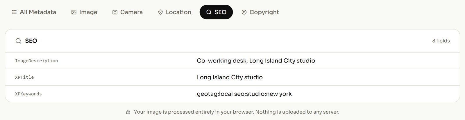
You can write the caption, creator and location fields yourself without a command line, and the tags written are the ones named in the tables above. Going the other way, if a photo is about to be published and the coordinates should not go with it, strip the location before you publish rather than trusting the platform to do it for you.