Construction Company SEO: What Site Photos Prove

Construction company SEO is settled by three things Google names: how well your profile matches the search, how far you are from the searcher, and how well known you are. Your site photos are not a fourth, and tagging them will not make them one. What those photos are is something more useful: a daily record of who was working where, on what date, at an address you can name. That record outlives the marketing question entirely.
Most contractors already take the photos. Almost none of them take the two minutes that turn a camera roll into an archive.
What construction company SEO actually moves
Google's guidance on local results names relevance, distance and prominence (Google Business Profile help). Photos are described there as a way to show customers what you offer, not as an input to ranking.
The tactic you have probably been sold, geotag your project photos and watch the local rankings move, has been tested rather than merely asserted. An agency ran a 10-week controlled study across 27 businesses, with five weeks of normal posting followed by five weeks of identical posting plus geotagged coordinates, and published it in March 2025.
One of seven metrics improved and four got worse. The author concluded it "hurts everywhere you don't add geotagged images", and the agency stopped doing it for clients.
Set the ranking argument aside, then. It is the weakest reason to care about what is inside your photos, and it happens to be the only reason anyone has offered you.
A progress photo is a claim about a date and an address
Every photograph your site team takes asserts two things: this was the state of the work on this date, and it was this work, at this address. Those two assertions are what get argued about later: in a payment application, a variation claim, a defects dispute, a warranty call five years after handover.
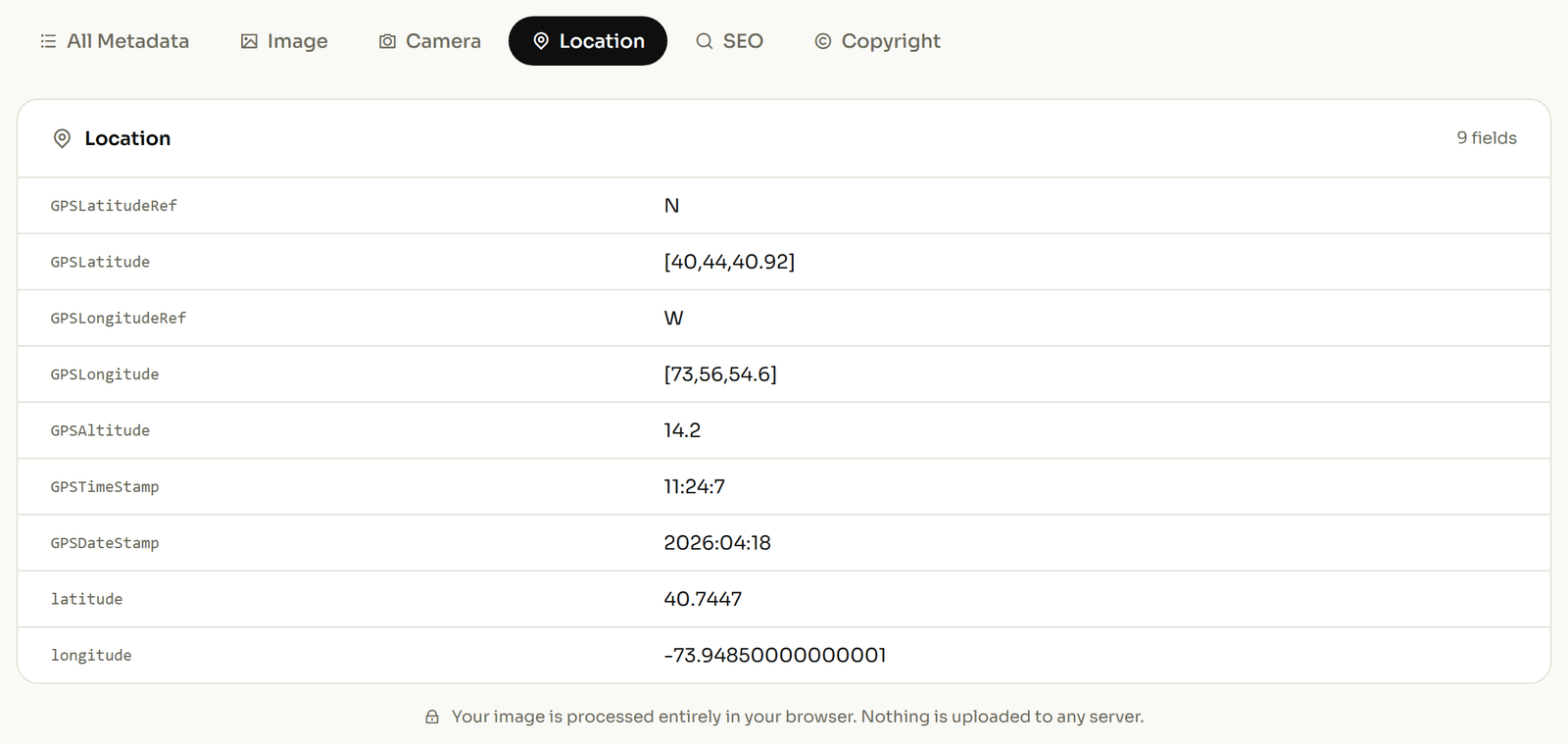
A phone records both automatically. The moment the shutter fired is written into the file as it is saved, in a field called DateTimeOriginal (EXIF field list), and it is not affected by when the file was later copied, renamed, or dropped into a folder. If location is switched on, the coordinates are written alongside it.
The gap is that almost nobody looks. A camera roll is not an archive, because nothing in it is addressable. You cannot ask it which photos were taken at the Dorset Street job in the second week of March. The information to answer that is already present in the files; it has simply never been read. Take one photo off a current site and open a site photo and see what it already recorded before assuming any of this needs new software.
Why a coordinate alone will not find your photo again
Here is the limit that matters on a construction site, and no article aimed at contractors mentions it.
A coordinate is precise about the ground and silent about everything above it. Take The Shard in Southwark, published at 51.5045 north, 0.0865 west (Wikipedia). A photo stores that in degrees, minutes and seconds, the units on a surveyor's instrument rather than a map app's decimals:
- The whole number gives the degrees: 51.
- The remaining 0.5045 of a degree, times 60, is 30.27, so 30 whole minutes.
- The leftover 0.27 of a minute, times 60, is roughly 16 seconds.
51 degrees, 30 minutes, 16 seconds north, which matches the figure published beside the decimal one in that source, so you can check the arithmetic rather than trust it. The longitude works out to 0 degrees, 5 minutes, 11 seconds, and because it is west of the meridian the file stores it as a positive number with a separate one-letter field holding the W. Lose that letter and the photo relocates itself to the wrong side of London.
Now the problem. That coordinate is the same for a photo taken in the basement and a photo taken forty floors up. Photos do carry a height, but it is stored as a plain positive number with a separate flag saying whether it is above or below sea level, and indoors it is rarely something you would stake a claim on.
What solves it is not a coordinate at all. A photo file has a short free-text location line that sits beneath the city: Sub-location, which holds up to 32 characters and is documented in the IPTC field list.
"Level 4, north core" fits. So does "Plot 12, rear elevation". That single line is the difference between an archive that answers a question in 2029 and forty thousand images of grey concrete.
What a photo proves, and what it does not
This section exists because the rest of the article would otherwise oversell, and a contractor who overstates their own evidence is worse off than one who never gathered it.
A capture time is written by the device's own clock. A clock can be wrong, and it can be changed. A location comes from the phone's positioning at the moment of capture, which is good outdoors and unreliable inside a steel frame. Nothing in a photo file is signed, and any of it can be edited afterwards. That includes you, which is precisely why it is not self-authenticating.
What a consistent, contemporaneous photo record does give you is a coherent account: hundreds of files whose dates and places agree with each other, with the delivery notes, and with the programme. Consistency across a large set created day by day is the argument, not any single image. Treat a photograph as a strong contemporaneous note rather than as a sealed exhibit, and it will do real work for you.
A documentation routine for an active site
Short enough that a site team keeps doing it in February.
- Switch location on for the site phones once, at mobilisation, and leave it on.
- Shoot each area from repeatable positions, so this week's photo is comparable with last week's.
- At the close of each shift, add the site address and the level to the batch in one pass rather than per photo.
- Put the level, elevation or plot number in the short location line: "Level 4, north core", not "site".
- Move the untouched originals off the phone weekly, into a folder named for the project.
Step three is where a day's photos stop being a camera roll. If a batch came off a phone with location switched off and you genuinely know where it was taken, it can be filled in afterwards; if you do not know, leave it blank. Never write an address into a photo that was not taken there. A false entry in the one part of a file people treat as objective is a liability, not a record. For photos that already carry coordinates, pulling the location back out of an existing photo covers how to read what is there.

The archive after handover
The photos matter longest after everyone has left. Defects periods and warranty claims run for years, and the question that arrives is always specific: what did that junction look like before it was closed up.
Keep the originals, not the published versions. Anything uploaded to a website, a portal or a social platform has usually been resized on the way in, and resizing is where the embedded dates and locations are discarded. The gallery copy is a picture; the original is the record.
One folder per project, originals only, with the dates and the location lines already written in. That is the whole system, and it costs a few minutes a day on an active site. If you are also building out location-specific pages for the areas you work in, location pages built around specific places is the related piece.
Related reading
Two more on the same problem, from a different trade.